


Hidden Valley Voting District, Salem city, Virginia
About
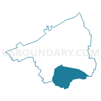
Outline

Summary
| Unique Area Identifier | 683209 |
| Name | Hidden Valley Voting District |
| County | Salem city |
| State | Virginia |
| Area (square miles) | 1.99 |
| Land Area (square miles) | 1.98 |
| Water Area (square miles) | 0.01 |
| % of Land Area | 99.32 |
| % of Water Area | 0.68 |
| Latitude of the Internal Point | 37.26433780 |
| Longtitude of the Internal Point | -80.04719830 |
Maps


Graphs
Select a template below for downloading or customizing gragh for Hidden Valley Voting District, Salem city, Virginia


Neighbors
Neighoring Voting District (by Name) Neighboring Voting District on the Map
- East Salem Voting District, Salem city, VA
- Lee-Hi Voting District, Roanoke city, VA
- Oak Grove Voting District, Roanoke County, VA
- South Salem No. 1 Voting District, Salem city, VA
- South Salem No. 2 Voting District, Salem city, VA
- South Side Hills Voting District, Salem city, VA
Top 10 Neighboring County Subdivision (by Population) Neighboring County Subdivision on the Map
- Roanoke city, Roanoke city, VA (97,032)
- Salem city, Salem city, VA (24,802)
- Windsor Hills district, Roanoke County, VA (18,206)
Top 10 Neighboring Place (by Population) Neighboring Place on the Map
Top 10 Neighboring Unified School District (by Population) Neighboring Unified School District on the Map
- Roanoke City Public Schools, VA (97,032)
- Roanoke County Public Schools, VA (92,376)
- Salem City Public Schools, VA (24,802)
Top 10 Neighboring State Legislative District Lower Chamber (by Population) Neighboring State Legislative District Lower Chamber on the Map
Top 10 Neighboring State Legislative District Upper Chamber (by Population) Neighboring State Legislative District Upper Chamber on the Map
Top 10 Neighboring 111th Congressional District (by Population) Neighboring 111th Congressional District on the Map
Top 10 Neighboring Census Tract (by Population) Neighboring Census Tract on the Map
- Census Tract 307.01, Roanoke County, VA (6,715)
- Census Tract 105.02, Salem city, VA (4,677)
- Census Tract 103, Salem city, VA (4,658)
- Census Tract 305, Roanoke County, VA (4,261)
- Census Tract 21, Roanoke city, VA (3,468)
- Census Tract 105.01, Salem city, VA (3,357)